Check your place
How do you live? See how your living environment scores with just one click. Your living environment is important for your health, after all.
How is the air quality? Are there many roads in the neighbourhood that cause noise pollution? Is there a lot of green in your area where you can relax?
Also handy for if you wish to move and get an impression of your new neighbourhood.
Type in your address and gain insight into the quality of your living environment with just one click. Scroll down for more background information.
How does it work?
The Check Your Place dashboard gives you a quick overview of the living environment around an address or location. If you select a location, the information is retrieved in real time from the providers of this data. Our system does not store the data locally.
Smileys
The score in the Environment Quality block is not shown as a number, but rather as coloured smiley (from green to red). The smiley indicates how well, or how badly, a certain environmental factor scores at the selected location (see explanation below). You can find the actual values of this location on the underlying map. Click on the title to open the map at the location of your choice. In the viewer, first click on the i-button and then on the location in the map to see the values on the location.
Fine particulates in the air
You can see the score of fine particulate matter concentrations of PM2,5 (particles smaller than 2,5 micrometer) in the air at the location of your choice. The concentration is averaged over one year (2017) and is expressed in micrograms per cubic metre (µg/m3).
Fine particulate matter is harmful even in low concentrations, there is no safe level. Therefore, the categories dark green and light green are not possible and the smileys are greyed out.
The particulate matter concentration is below the recommended value (10 ug/ m3)
The particulate matter concentration is between the recommended value (10 ug/ m3) and the limit value (25 ug/ m3)
The particulate matter concentration is above the limit value (25 ug/ m3)
Nitrogen dioxide in the air
You can see the score of nitrogen dioxide concentrations at the location of your choice. The concentration averaged over the year 2017 and is expressed in micrograms per cubic meter (µg/m3).
Nitrogen dioxide is harmful even in low concentrations, there is no safe level. Therefore, the categories dark green and light green are not possible and these smileys are greyed out.
The nitrogen dioxide concentration is below the recommended value (20 ug/ m3)
The nitrogen dioxide concentration is between the recommended value (20 ug/ m3) and the limit value (40 ug/ m3)
The nitrogen dioxide concentration is above the limit value (40 ug/ m3)
Sound
You can see the scores for noise from road traffic, rail traffic, air traffic, industry and wind turbines at the location of your choice. The noise impact is expressed in Lden (Lday-evening-night), the measure for the average noise impact over a 24-hour period (Lday-evening-night).
Very good, the noise exposure is less than 45 dB
Good, the noise exposure is between 45 dB and 50 dB
Reasonable, the noise exposure is between 50 dB and 55 dB
Moderate, the noise exposure is between 55 dB and 60 dB
Poor, the noise exposure is more than 60 dB
Summer heat in the city
JYou can see the score of the urban heat island effect (UHI) at your chosen location. This is the average temperature difference ( in °C) between the urban and surrounding rural areas.
Very good, the temperature is less than 0.5 °C higher than in surrounding rural areas
Good, the temperature is between 0.5 and 1 °C higher than in surrounding rural areas
Reasonable, the temperature is between 1 and 1.5 °C higher than in surrounding rural areas
Moderate, the temperature is between 1.5 and 2 °C higher than in the surrounding rural areas
Poor the temperature is 2 °C or more higher than in the surrounding rural areas
Shady trees
You see the score of the percentage of trees in a neighbourhood. The higher the percentage, the greener the neighbourhood. This score is based on the map Trees in the Netherlands.
For the score, it is important where the neighbourhood border runs. A nearby woodland or park, for example, can lie just outside the neighbourhood, causing the score to be lower than how people experience a neighbourhood.
Very good, more than 15 % of the area of the neighbourhood
Good, between 10 and 15
Reasonable, between 5 and 10 %
Moderate, between 2.5 and 5 %
Poor, less than 2,5 %
Amount of Green
This is the score of the amount of green (grass, bushes, trees) in a neighbourhood. The higher the number, the greener the neighbourhood. This score is derived from the Green Map of the Netherlands.
It is important for the score where the neighbourhood border runs. A nearby woodland or park, for example, can lie just outside the neighbourhood, causing the score to be lower than how people experience a neighbourhood.
Very good, more than 65 % of the area of the neighbourhood
Good, between 55 and 65 %
Reasonable, between 45 and 55 %
Moderate, between 35 and 45 %
Poor, less than 35 %
Sport and exercise facilities
You can see the score of how much the municipality of your chosen location is equipped for sports and exercise. The average score in the Netherlands is 2.6 on a scale of 1 to 5. This score is derived from the map Kernindicator Beweegvriendelijke Omgeving. This is an average per municipality. It may be possible that the exercise opportunities at your chosen location are better. There may also be surrounding municipalities that score better or worse, which means the score is different from how people experience the exercise opportunities.
Very good, more than 3,5
Good, between 3 and 3,5
Reasonable, between 2,6 and 3
Moderate, between 2 and 2,6
Poor, less than 2
Air quality important for new living environment
Lucht inhoud
Clean air
Everyone wants to breathe the cleanest air possible. That is important for our health. But breathing clean air is even more important for people with airway complaints, asthma or allergies. That is why more and more people are looking for clean air when they are looking for a new house.
Differences
Air quality differs from place to place, depending on the amount of industry, traffic and agriculture. Are you hesitating between two houses and are you sensitive to respiratory complaints? Then the air quality might be the deciding factor.
View air quality on the map
View the air quality in your current or new residential area on our maps. Our maps of Particulate Matter and Nitrogen Dioxide show the average levels of fine dust and nitrogen dioxide at a specific location. Visit our More about Air, Particulate Matter and Nitrogen Dioxide pages for trends in concentrations, more in-depth information and tips on what you can do to improve air quality.
Frank checks....
Frank Paats test de tool Check je plek in zijn eigen leefomgeving uit.
Noise and sleep disturbance
Unwanted sound
Unwanted sound in our living environment can be a nuisance and disturb our sleep. This can lead to health complaints. Are you sensitive to noise? Prevent unpleasant surprises by checking how your new living environment scores on noise. Look at the map to see how much noise there is in your new living area from road traffic. Or from train traffic or air traffic.
Experiencing noise pollution
The Dutch experience serious noise pollution from road traffic (9.3%) and neighbours (8.4%). Ask the current residents about the neighbours. View the maps showing the noise pollution experienced per municipality on the Sound page or check out our tips on what you can do yourself to reduce noise pollution.
Looking for peace and quiet?
Do you enjoy the quiet? See if there is a Quiet area in the vicinity of your new home.
How much hotter is it there?
Heat sensitive?
Climate change means that the weather is getting increasingly warmer. If it is very hot, you can suffer from heat stress. If you are sensitive to heat, bear this in mind when looking for a new home. It is best to live in a rural area. The annual average temperature difference (in °C) can be as much as three degrees from the city. On hot summer days, the difference can be even greater. Especially during the evenings when the countryside cools down faster than the city.
Do you live in a city?
Check how hot your new living environment can get compared to the countryside on the Urban Heat Island effect map. Is this too hot for you, but would you still like to live in a particular city? Check the map to see if it is cooler in other neighbourhoods, or read about what you can do yourself to combat the heat on the Heat page.
Cooling down in the city
The presence of water and greenery can cool down a city. Our map Cooling effect of green and blue shows the extent of this effect in your new living environment. Or take a look at the map of swimming water locations where you can take a refreshing dip.
Green makes for health and an attractive living environment
Property value
A row of trees in a street, cheerful flower beds in a neighbourhood or a beautiful park in a busy city offer a nicer view than a bare environment with only stone buildings. Well-maintained greenery can therefore increase the value of your home.
Health benefits
People feel healthier in a green living environment. This applies to both urban and rural areas. It is nice to be able to relax or move around in green surroundings. Green is also good for a healthy living environment. For example, greenery provides cooling in the event of heat stress and helps with flooding. Green also provides more biodiversity (e.g. more species of birds).
View the map
Explore the Green Map to find out how green your new living environment is. Also check the accessibility and experiential quality of the greenery. Or discover how many trees there are and how tall they are. See whether there are enough facilities for exercise in your new neighbourhood. Or get to work yourself and check out our tips for a greener living environment.
Are there any risks of accidents, fire or flooding?
Everyone wants to feel safe
Of course you want to feel safe in your new home. Our maps provide insight into a number of risks. This way, you can be optimally prepared for your new home.
Flooding
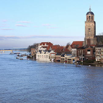
View the map to see where the water will accumulate during a short period of heavy precipitation and whether your new home will keep your feet dry during a flood. Read more about flooding.
Lead pipes
Homes built before 1960 may still have lead pipes. Lead in drinking water can pose a health risk. Check our Addresses Map (BAG) to see if your new house was built before 1960. New materials in newly built houses or houses with new taps or pipes can still give off small amounts of lead in the first three months. See the flushing advice. Read more about lead pipes on the RIVM website.
Soil
My house stands on wooden stilts. Is it in an area where the ground is subsiding? See our map with the last 100 earthquakes in the Netherlands.
How movement-friendly is your new neighbourhood?
Do you exercise a lot in your free time?
Then you want to know whether that is possible in your new neighbourhood. And did you know that the layout of your living environment influences how much you exercise? The environment can invite you to take your bike because of the beautiful cycle paths. Or you might pass three gyms every day and think 'Now I'm going to work out too'!
How exercise-friendly is your new neighbourhoud?
Take a look at on the map activity friendliness to get an impression of your new neighbourhood. This depends on the presence of sports halls / sports parks, playgrounds, parks and water to play, swim or sail. But also the length of walking and cycling paths and the distance to amenities such as supermarkets and schools.
Per characteristic
Our map shows the total score for these characteristics. Is it only playgrounds that are important to you? Or the cycle paths? Then consult the scores per characteristic at Sports on the Map. Maps of cycle paths and footpaths can also be found in this Atlas.


